Sunday, August 6, 2017

Jeep ride through Engineer Pass near Silverton, CO

Engineer Pass, Silverton, CO

After enjoying our mine tour and breakfast at the Bachelor-Syracuse Mine we headed toward Silverton but made a detour near the Red Mountain Pass on a bypass at the Ghost Town of Ironton to explore the standing old buildings.  Settled in 1883, within three weeks three hundred buildings were being built.  Ironton was a major transportation junction between Red Mountain and Ouray in addition to having some of its own mines. Ironton had a peak population of over 1000 and had two trains arriving daily from Silverton. There were many chain stores from the nearby cities of Ouray and Silverton. The town lived into the first part of this century and has slowly faded since then (Ghosttowns.com).


And some great scenery around the area.


As we continue to explore we drove by some of the old mines in the area with great views of the area.


We stopped at Yankee Girl mine that was one of the richest silver producers in the area where they hit a natural column of silver ore so pure that it didn't have to go to the mill and went straight to the smelting room for melting into ingots.


Then after lunch in Silverton, we headed up the road to Animas Fork and the start of Engineer Pass.


 We saw some of the local wildlife in a bunch of the Marmots running across the road ahead of us.


And this male grouse that was strutting his stuff for a hen sitting in the bushes next to him beside the road and they didn't react to us driving by...


As we made our way up Engineer Pass we noticed we had the road to ourselves which gave us time to stop and enjoy the area and take photos.


 Once we took some photos along this tall snow drift we then continued down the other side and into Lake City and back to the house in Montrose.

 We had a great day out exploring the back roads even thou none of it was 'rough' four wheeling !

 More to come as the summer goes on.... Enjoy your travels !

Sunday, July 23, 2017

Weekend Adventure at the Bachelor-Syracuse Mine Tour

June 2017 -

The Colorado snow is beginning to melt and the off-road trails are beginning to appear.  We had reports from the various organizations are some of the lower trails were open but warned it might be wet and muddy.  So we headed out to see for ourselves.
 
First on our list was to visit the Bachelor-Syracuse Mine for the breakfast and tour.  We've heard so many good reviews on the both the breakfast and tour that it was on list to do and we did not make time last year for it.  So both of us are hungry for food, mining history and off-roading we headed to Ouray from Montrose.
 
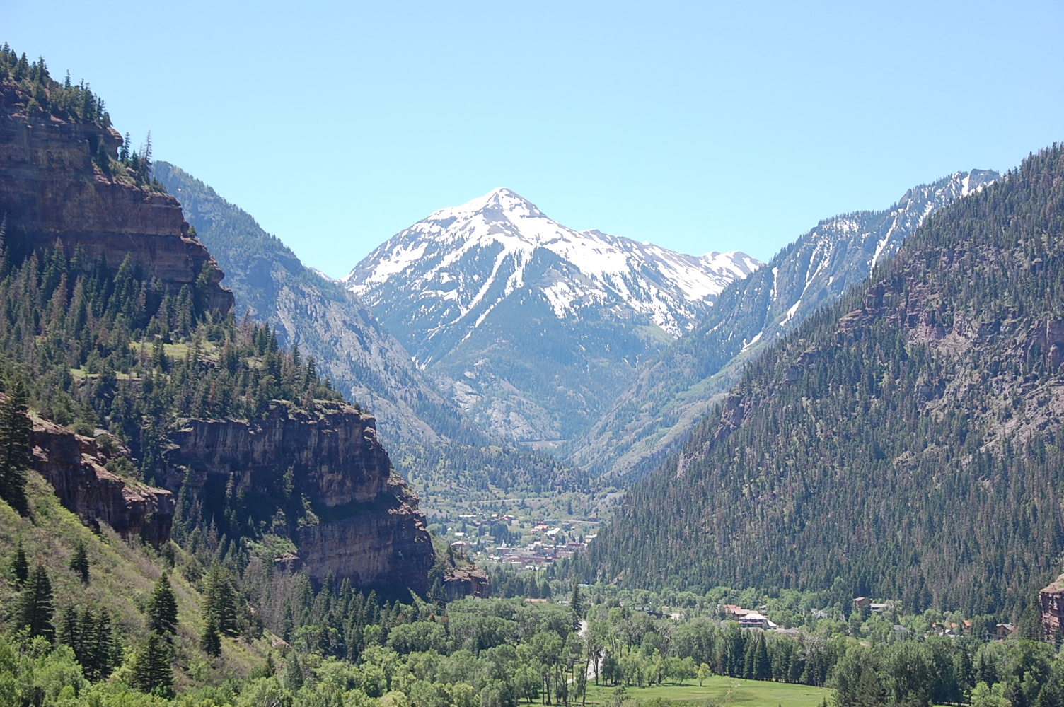
We drove US 550 to the turnoff for County Road 14.  Of course the mountains are beautiful and we experienced an awesome view of Ouray while driving up to the mine.


Bachelor-Syracuse Mine History
During the main silver rush in Ouray (1876 to 1893) most of the silver mines were located up Box Canyon, up Canyon Creek in Yankee Boy and Imogene Basins, and around Ironton and Gastun to the south of Ouray. One other area was north of Ouray around what became known as Gold Hill. There was enough gold at the site to survive the Silver Panic of 1893. The Bachelor mine was claimed in the early 1890s by three bachelors, C.A. Armstrong, Frank Sanders, and George R. Hurlburt. Seeing as how none of them were attached, they settled on the name Bachelor Mine. It was a high producer and eventually bought out other claims in the area. The main shaft drilled downward from the top of the hill and eventually reached over 2000 feet into the mountain. As the shaft got deeper, ground water began to flood the mine and it became increasingly expensive to haul every ore bucket up out of the mine through the shafts to the top of the hill. A drainage adit was drilled from the east, which allowed the mine to go even deeper. In the 1920s, another adit was needed to come in from the west into the bottom of the mountain to drain deeper water and allow the ore to be removed more easily. It was hoped that the adit would pay for itself by encountering new ore bodies along the way, and it was named the Syracuse Tunnel since the money to build it was raised mostly in Syracuse, New York.


Oops - we didn't get any photos of our breakfast but it was delicious.  I picked the Tiny Breakfast with 1 egg, bacon, potatoes & toast and Jack ordered the Big Breakfast which was 2 of everything I had plus biscuits & gravy.  We would recommend getting there early before the tour and fill your stomach with good food.

Let the tour begin -


Today, the mine tour begins at the mine opening. We walk in about 1500 feet after suiting up with hard hats and I also elected to wear the yellow rain slicker. When the tram was running, the tour went in 3500 feet, but this deeper tour is no longer allowed for safety reasons. As we walk inside along the tram rails that use to carry visitors into the mine the temperature gets a little cooler and damper with water dripping from the ceiling in places and a steady stream of water flowing out of the mine in a ditch to the right of the tracks.

While in the mine our guide told us about the history of the mine, showed us how the pneumatic drills were used to hammer out a series of holes in the face following a pattern of concentric circles. He even turned the lights off and lit candles so we could experience the actual lighting conditions used in the mine.


Tunnel moisture forms strange mineral formations on walls of tunnel.


So if you are in the area we recommend the Bachelor-Syracuse Mine Tour.  The next post will continue with our off-road adventure on this day through Red Mountain trail, Silverton, CO and Engineer Pass trail.

Until next time - Enjoy your adventure!

Sunday, June 25, 2017

Easter Jeep Safari 2017

Fun in Moab, Utah

at Easter Jeep Safari 2017


April 8th - 16th was a week packed with Jeepin' fun.  This was our 4th year to attend the Easter Jeep Safari organized by the Red Rock 4-Wheelers club.  Thousand of jeeps and off road vehicles sign up to participate in a number of trail runs known throughout the Moab area.  The scenery is made up of beautiful red rocks.  The Moab area is also known for Arches National Park, Dead Horse Point State Park and Canyonlands National Park.  With or without a 4-wheel drive it's well worth a visit.  The Easter Jeep Safari is also a great time to ooh and aah over all types of vehicles, from customized rock crawlers to the older seldom seen classic Jeeps.

We started our trip leaving Scottsdale on Saturday morning and not wanting to push it to make it all the way in one long 10 hour day, we stopped and spent the night in Bluff, Utah at the Cottonwoods RV park.  This gave us the chance to explore the area that we've driven through a number of times but never took the time to stop.  We found this rock formation called the locomotive rock. 


We found the Sand Island Petroglyph site and were able to see the many years of natives applying their art and stories to the rock walls


After a great morning exploring in Bluff, we headed on to Moab which was just a easy 2 hour drive on up the road and get checked into our spot in Moab.

We once again stayed in the Moab Rim Campark at the South end of Moab.  The park sits above Highway 191 which gives us a birds eye view of the rigs as they come and go from town.


 View from our RV site - LaSalle Mountains


We signed up for three club sponsored trail runs.  We enjoyed Dome Plateau, 3-D and Hells Revenge trails.  Below is a photo from Dome Plateau and one of a number of arches seem on this run.


A stop along the way on Dome Plateau trail was Cow Springs which had these large natural caves in the rock wall face and a natural spring coming out one which the local ranchers used to water a cattle pond.


Hells Revenge trail was a true 'Slickrock' trail and offered some good four wheeling challenges with tall near vertical climbs in which the 'lockers' had to be engaged but the JK accepted and passed all the challenges put at it all week!


On days in between trail runs, we like to explore on our own around the Moab area and this year we checked out Deadhorse State Park which is just Northwest of Moab and over looks the Colorado river and great views of the Canyonlands beyond for as far a one can see.  We could see the famous plateau and cliff named 'Thelma & Louise Cliff' which was where the movie scene were filmed where Geena Davis and Susan Sarandon drove the '66 Thunderbird over the edge at the end of the movie.


On the way back from Deadhorse State Park, we made a back roads detour and found Gemini natural bridge arches which are two arches side by side in the same rock but are separate arches as they have a large gap between them and we were able to walk across the tops of them.  In fact in the years past, they use to allow you to drive down and across them and actually park your Jeep on the top them.  Walking across was good enough for us!


We enjoyed our week in Moab filled with Jeeps, trails and beautiful scenery.  
Sign us up for next year.  

Until next time - Enjoy your adventure.

Friday, October 14, 2016

Gold In The Hills

September, 2016
Montrose, CO via Rimrocker Trail to Naturita, CO.
Return via back roads from Norwood to Dolores and back to Telluride, CO.

Gold in the hills ! Our eyes were on overload with the beauty of the golden color of fall leaves on our weekend trip from Montrose, CO via the newly opened Rimrocker Trail to Naturita, CO and return via Route 145 from Dolores to Telluride. 
 
The Rimrocker Trail is a road that allows you to enjoy 160 miles of off-pavement travel while experiencing the many different stunning landscapes that connect Montrose, Colorado to Moab, Utah. The roads on the eastern half are graded gravel roads that are two vehicles wide and would easily be traveled in a non four-wheel vehicle. We had heard that it was a fantastic destination to travel through the aspens during their fall color changes as well as some fantastic views at the overlooks. 
 
Between Montrose and Nucla, the roads travelled are mainly graded roads that would be suitable for most vehicles which started west of Montrose as the 'Divide Road' crossing the Uncompahgre Plateau at about 9500 foot in elevation.  Along this segment there are countless trail spurs on each side of the road that looked inviting to explore as the terrain is evergreen forest with a variety of aspen trees with many options for camping near green meadows.  Dropping off the higher plateau down in to red rock country to the town of Nucla.  The roads change from dirt to pavement as you pass through the town and then revert back to dirt nearing the canyon trails. Nucla is from an era of the start of the nuclear age in the 40's as Uranium mines dot the landscape with signs of mining equipment here and there. 

We decided to only drive the Colorado half of the Rimrocker trail, ending at Highway 141 and the Dolores River crossing.  We'll save the red rock and Utah portion for another weekend trip. 


View of the Delores River and Utah near the end of the Colorado portion of the  Rimrocker Trail at Highway 141.

Road shots of Delores River on return trip through Delores, Rico & Telluride.


Fall is an amazing and beautiful time in Colorado with the abundant of color experienced in the past four weeks.  The colors are slowly fading and falling from the trees to mark the start of winter.  We hope this will not be our last adventure to Colorado in the Fall.
 
Until next time - Enjoy your adventure.