Sunday, April 3, 2022

Annual Spring Arizona Jeep Rendezvous


 March, 2022 
 Arizona Annual Jeep Rendezvous
Driving the Great Western Trail


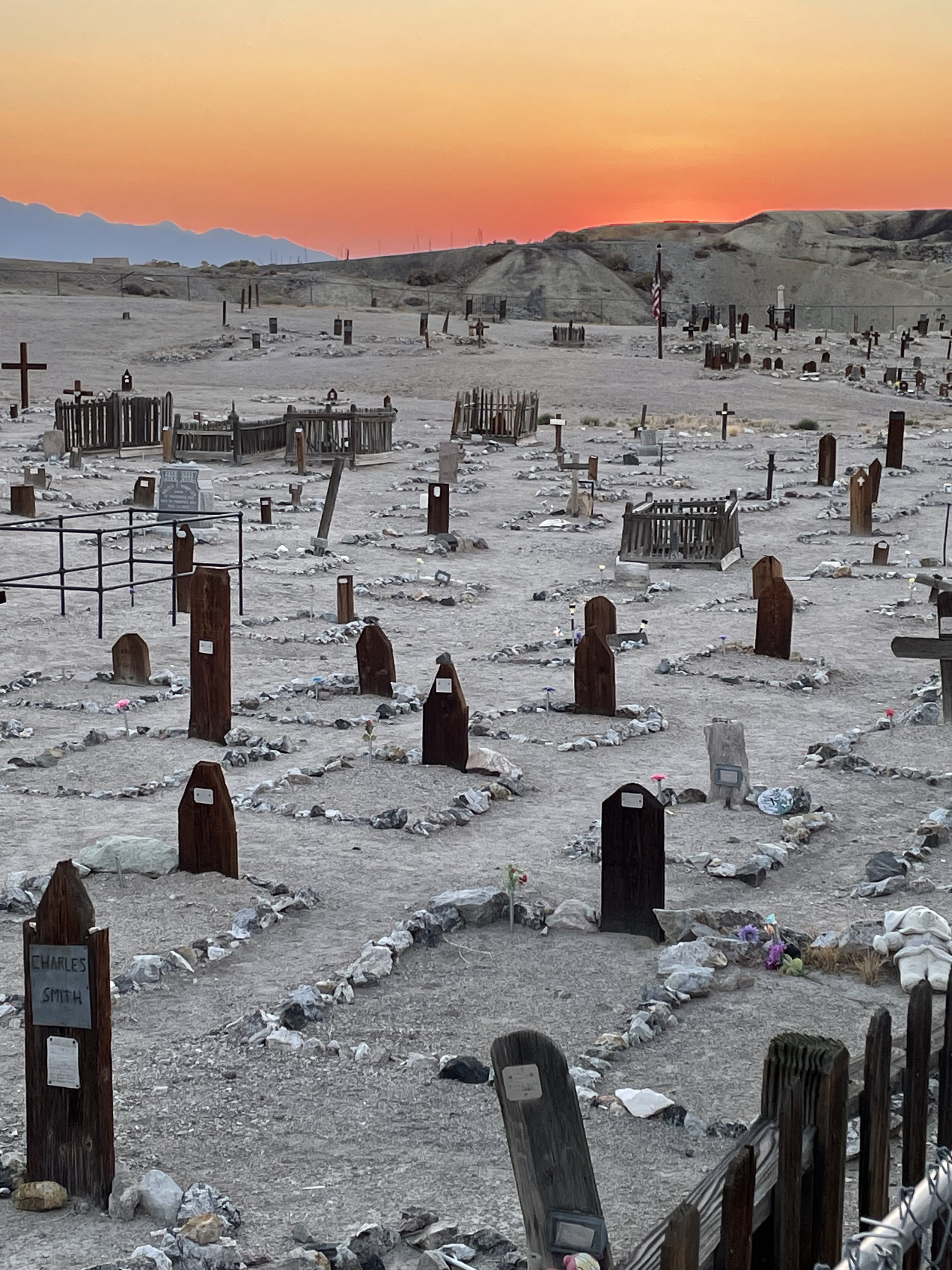
When Jack was working in Montrose, Colorado (2015-17), we joined the Western Slopes 4-Wheelers club. The group was a fun way for us to 4-wheel the Colorado backcountry and get to know the trails and history of the area.  We have stayed in touch through the years and some of the members make a 'get away from the Colorado cold' by coming to sunny Arizona for a few days for desert 4-wheeling.  We always look forward to the annual Arizona run and seeing friends. This year two couples made the trip down to Arizona and the plan was to run 4 trail sections in 3 days.  The weather was beautiful for 2 of the days but didn't completely cooperate on the second day.    The group decided to actually abandoned that day of trails so Jack and I did a day of geocaching, adventure labs and a quick pre-run for the next day's trail.

All the trails we drove are considered part of the much larger Great Western Trail.  The GWT trail is a loose collection of short north-south trails which runs 3,000 miles from Mexico to Canada. It goes through five western states, Arizona, Utah, Idaho, Wyoming and Montana.  The history was briefly noted on this Great Western Trail sign (photo below) at the beginning of the trail for Day 1.


We completed only three portions of the GWT.  So many trails so little time....

Day 1: 

Butcher Jones Trail Section - This section is located NW of Phoenix along St Rt 87 in a recreational area encompassing 27,000 acres to 4wheel, camp and enjoy the outdoors. It was named after WW Jones, a doctor who grazed cattle in the area during the 1800s. 

After airing down our tires we hit the trail where the desert was alive with spring wild flowers which made for a many good photo stops along the way.  


Brittlebush

Mexican Poppy

The terrain for the most part was smooth hard packed ground and was like being a on roller coaster with ups and downs, twist and turns and sandy washes leading to the waters edge of Saguaro Lake.  Here we relaxed, had lunch, watch wildlife and soaked in the beauty (with some wind). 

Right to Left: Jess & Gigi (Gladiator JT); Lester & Ruth (2-door Rubicon Wrangler JK);
Jack & Deb (4-door Rubicon Wrangler JK)
At the Perfect lunch stop

Our Jeeps and drivers were tested on a moderate decent down a steep, rocky and partially washed out hill where we all maneuvered like champs and did the same on the way out as we drove up the same rocky hill. 

Saguaro Lake in background. Lester and Ruth
crest the steep rocky road.


Jess and Gigi crest the same rocky road at a steady pace.

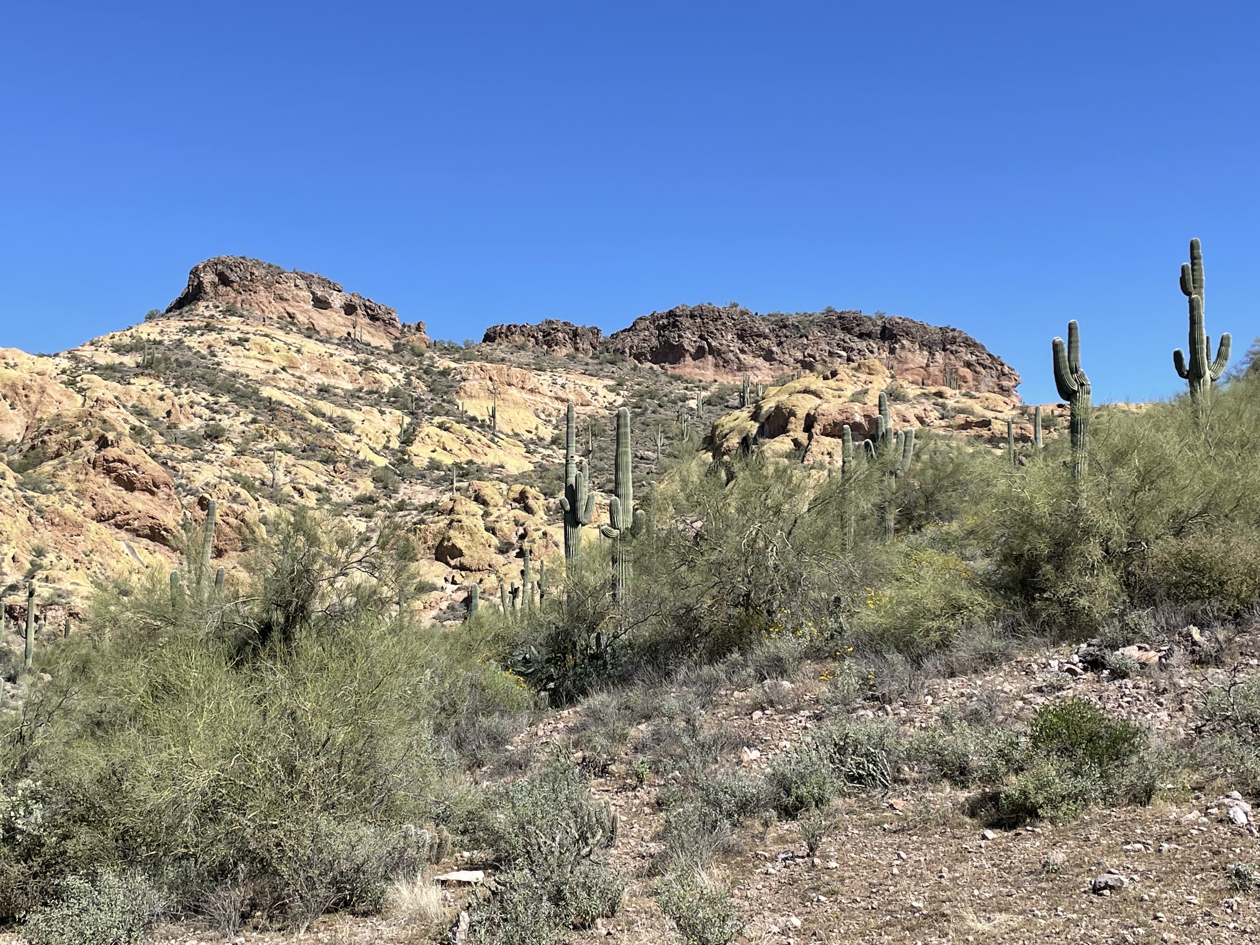
The views in this area were amazing with the Superstition Mountains as the backdrop to the South, Four Peaks mountain range looming in the East and the Sonoran desert surrounding us the whole day.

As we came to the end of the Butcher Jones Trail we then crossed St. Rt 87 and immediately began driving the next section of the Great Western Trail called Lower Sycamore Creek.  This trail was made up of varying levels of off-roading  consisting of rocky road, quite a few creek crossings, sandy washes, and a very narrow curvy area that was consider a lot of fun and technical from all of us. 

Beautiful scenery and Four Peaks in the back ground


Here comes Lester and Ruth on our flower lined trail


Desert Marigold


Our windshield view most of the day


As we were approaching the end of our day, we had one more stop and that was to view a rarely seen Crested Saguaro cactus. It was a beautiful specimen of a Crested Saguaro and I hope it continues to thrive for many more years.  Here is an explanation from google about the Crested Saguaro:

"Cristate or “crested” saguaros form when the cells in the growing stem begin to divide outward, rather than in the circular pattern of a normal cactus. This is an unusual mutation which results in the growth of a large fan-shaped crest at the growing tip of a saguaro's main stem or arms."

Crested Saguaro

Standing proud in the desert skyline


Day 2 - Since it rained on and off all night we had great intentions of driving the Montana Mountain trail/road because we figured it might be less effected by the weather elements than other low lying trails. We did attempt this run thinking the 'storm would pass' but as we neared the trail head, Mother Nature hit us with heavy rain showers that started to flow the dry washes, some hail thrown in that turned the side of the road white and a few LOUD cracks of lightning just to up the dangerousness of that days trail run, so we decided to not do a trail and made plans for the next day's run.

Since Jack and I were about an hour from home and in an area we don't frequent, I talked him into finding some geocaches and tour an adventure lab in the Apache Junction area raining or not.

Adventure Lab took us to area murals.
This one was found on the Hitching Post Saloon.

Mural near the Flatiron Park. We had to count 
the ladybugs in the mural.

After the worst of the rain had passed we decided to pre-run the next days planned trail a short distance to make sure the trail would be drivable. The much needed rain nourished the desert and left the desert smelling clean and earthy while the foliage took on a renewed burst of colors. We concluded that the trail would be perfect for the next day and cut our pre-run short and headed home.


Day 3 -  Bulldog Canyon Trail - This trail is also noted as part of the Great Western Trail and  provides access to the beautiful Sonoran Desert and Goldfield Mountains and is part of the Tonto National Forest.  The trail was fun, very scenic with a few steep areas, sandy washes and distinctive yellow-colored lichen covered mountains. The phone photos do not do the colors justice. They were quite a sight to see. We hit the Arizona wildflower show at peak the performance. 


Some of the climbs and descents from hills to ravines  


More rocky ledge wheeling


Our windshield view for this trip

Soooo, we were getting close to the end of the trail and I really wanted one geocache for the day. So I picked one cache and we all stopped so I could find this cache - Chocoholic Emergency Kit tin. It was hidden under a SPOR (suspicious pile of rocks). A quick find and sign for me while most of the others were more interested in photographing the nearby blooming Hedgehog cactus.


We had driven approximately 5 miles on the Forest Rd 1356 and then about 8 miles on Forest Rd 10 to end our adventure - but wait- there’s more. The day was still young so we decided to backtrack a mile or so and take Forest Rd 3554 to our new exit. This trail was unlike the desert rocky road we had driven all day. It was a smooth wide sand wash with some trail sections sideXside modified into high bank "race track" that made the drive even more different as we made our way out 7 miles to the Usery trailhead.

Once at the trailhead we all aired up and said our goodbyes until next time. 2023 Arizona Annual Jeep Rendezvous is already in the planning stages. 

Special thanks goes to Ruth, Lester, Jess and Gigi for the fun times shared. 

Until next time - be well and happy travels. 

Jack & Deb


Thursday, September 30, 2021

Oregon Road Trip Anyone?

Oregon road trip anyone OR have tools will travel..... 

We have been known to jump at any opportunity to get out the Arizona heat. So when Jack's brother mentioned he was needing some help replacing tile flooring we decided to throw some clothes in the Jeep and get out of town for a couple of weeks and go north to Oregon. It was mostly work related but we did squeeze in some fun stuff including some awesome geocaching.

After driving over 500 miles from Scottsdale, AZ to Tonopah, NV we stayed in the newly restored 1906 historic landmark which started it's life as the Nevada State Bank and Trust and now as the newly renovated Belvada Hotel. The accommodations were very nice and so comfortable that we actually stayed there on the way back down to AZ also. 

Belvada Hotel - Restored 


Nevada State Bank & Trust / Belvada Hotel - Circa 1906


The interior lobby was so welcoming.


Our King bed room

Also located 'not far' from Tonopah, NV is the 'Oldest Cache in Nevada' and of course I talked Jack into driving another 60 miles (one way!) so I could check this off my geocaching list.

Nevada's oldest geocache

This cache has been in existence since 12/26/00 and is located in a very remote desert area on 18 miles of dusty dirt open range road where we saw a few horses and cows. Many geocachers make the pilgrimage to this cache merely to write their name on the log and add it to their list of accomplishments. Me included. We had fun locating it (sorry I can't reveal the exact location - it's a secret LOL), logging it and admiring the desert terrain before heading back to town for dinner.

Once we were back in Tonopah and after dinner, we visited the Old Tonopah Historic Cemetery where we also caught the sunset. This particular cemetery is dated between 1901-1911. If you stroll the grounds you will see some of the causes of death like fire, mining accidents, plague and murder.  There is actually a brochure that is a walking tour through the cemetery.  

Old Tonopah Cemetery
*********

After several more miles and a couple of delays and detours due to the Dixie Fire, we finally reached our destination in Grants Pass, Oregon. Jack started to work with Bill on helping with the tile work and Donna and I kept out of the way by entertaining ourselves. I quickly introduced her to geocaching and off we went to explore the area, visit an art gallery and shopping.


Donna's first cache - Whimsical Frogs made
by a chainsaw artist. Cool carvings.

 
Grants Pass, Oregon is known for da' 'Bears'.  The first bears were created in 2003 at the request of Brady Adams, former President of Evergreen Federal Bank. Local artists design each bear uniquely and the finished product is displayed on the downtown streets of Grants Pass in the summer. In the winter the bears are removed to the 'Bear Hotel' to hibernate. The number of bears is ever changing but there is typically around 50 bears on display plus the ones that have been privately acquired. These are some that we visited.

BOLO - the Police Bear

Bear Necessities - the Fire Station Bear

Post Office Delivery Bear

After the floor was nearing completion Jack and Bill needed a 'work' break so we loaded up in the car and  headed west to drive Highway 101 along the Oregon coast for the day. We were greeted by  beautiful scenery, cooler weather and good seafood.

Face Rock State Scenic Viewpoint - Bandon, OR


The path to the beautiful viewpoint

Arch Rock Cove on the short trail out to view point near Brookings, OR

Arch Rock between Gold Beach and Brookings, OR

Looking North along the coastline near Arch Rock


Waves at Brookings, OR
***********

On our way back to Arizona I again talked Jack into a detour (not fire caused!).  This time to the 'Oldest Cache in Oregon'. It was only a mere 300 miles out of our way.  No problem - we're retired! 

The cache is located near the edge of the Mt. Hood National Forest. We had to put on our hiking shoes and hike down to the cache through a enchanted forest of trees, mushrooms and ferns. Only to huff and puff back up the mountain to the car. It took us 2 hours but it was well worth the adventure.

Oldest Oregon Geocache

Scenery along our hike to cache

Some of the leaves beginning to show 
their colors

Hiking path

*********

Over a thousand miles later we finally made it to Flagstaff, AZ for a couple of nights before heading home. Jack and I both attended NAU and that's how we met 39 years ago (married for 37 years) so we always like hanging out in Flagstaff especially when it is really cool at 7000 feet in elevation and really hot in Scottsdale. We stopped at the Friday night hot rod show and Sunday we completed an Adventure Lab (connected to geocaching) created by our friend, Vivian.  Her Adventure Lab, Historic Route 66: Flagstaff to Williams, AZ shared 10 historic locations where we learned about the past movie set of Easy Rider, the highest point on Route 66 and the bizarre fence made of skis. It was fun and a good way to end the day before heading home.

Hot Rod Show on Route 66


Movie setting for Easy Rider. In the film
they pull up on motorcycles to get a room for the
night and the motel owner shuts the door and 
turns on the no vacancy sign.

Bizarre Ski Fence along Route 66

Old concrete of Route 66

One of the painted Historic US 66 Route road shields. 

And there you have it.  We ended our adventure by 'Getting our Kicks on Route 66'.

Until next time. Be well. You never know when the next adventure will pop up. 

Happy Trails,

Jack and Deb