It was my turn to drive the Jeep for the weekend so I researched jeep trails in the Colorado Backroads & 4-Wheel-Drive trails guide and decided that the Last Dollar Road was my kind of trail.
The Last Dollar Road is located between the towns of Ridgway and Telluride, CO. We drove about 12 miles from Ridgway at approximately mile marker 12 on Highway 62 where we saw a small Forest Service sign at the turn off saying ' Last Dollar Road'. I should mention that Highway 62 from Ridgway, CO offers massive views of the Sneffels range part the San Juan mountains in the area and are worthy of a stop at the Dallas Divide pullout.
Spoiler Alert: There are a lot of scenery photos.
Welcome to Last Dollar Road
 |
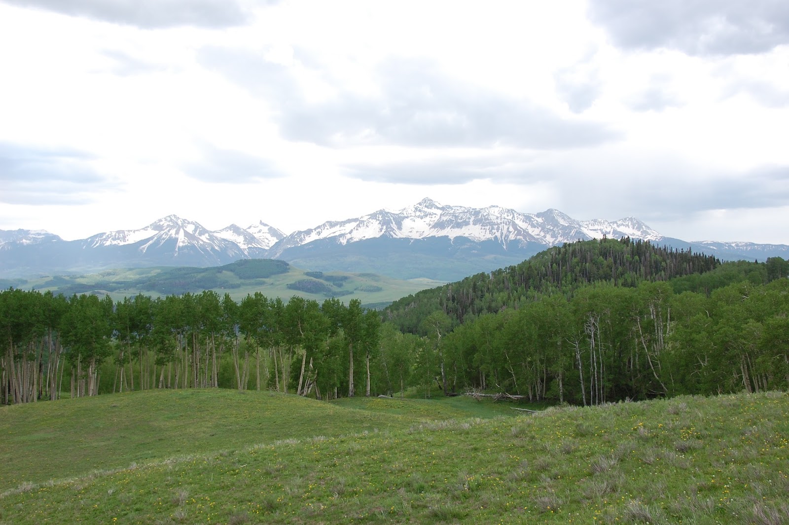
| Last Dollar Road looking at Hayden Peak 12,967ft (left) and North Pole Peak 12,208ft (right)
Along with beautiful views around every corner this area also has cowboy ranching history known as the Last Dollar Ranch. It contains approximately 392 acres that borders the 13,000 acre property owned by clothing maker Ralph Lauren. In the past years the ranch has been used as a location for numerous ads for Anheuser-Busch, Coors and Marlboro.
|
 |
| The Last Dollar Ranch Gate. Hayden / North Pole Peaks in the background. |
 |
| We saw abundant wildflowers along the road |
 |
| Mountain Lupine |
 |
| Can't resist taking photo of old buildings |
 |
| Aspen lined road |

 |
| Looking west into the San Miguel River Valley |
After reaching a summit at approx. 10,700 feet we started to make our way slowly down the slightly steep road overlooking the large meadows dotted with pine and aspen trees.
 |
| Meadow |
Once we drop over the summit we were greeted by the view of Wilson Peak. At 14,017 feet Wilson Peak is the highest point in San Miguel County and the 48th highest Fourteener. Other than being ranked as a Fourteener, Wilson Peak is recognized for another reason and our beer drinking friends may know this bit of trivia. Wilson Peak is on the Coors labels.


 |
| Wilson Peak slightly to the left. |
Once again, we can't resist taking photos of old buildings. If only we knew the history of the buildings.


We knew that the Last Dollar Road was an old mining & sheep herding road between the Ridgway and Telluride area but we never imagine that they needed to fill up along the way at an old Conoco gas pump on the trail.


We gradually leave the wildness area and enjoy the short drive through million dollar homes sites overlooking Telluride with the ending point being the Telluride Airport.
This Jeep trip was easy driving with awards of abundant scenery, history, flowers and aspens. We plan to return in the Fall for the fall colors. Can't Wait !
The mountains are calling and I must go - John Muir


