When we made our summer trip plans we kept in mind that we needed to be in Cody, Wyoming to meet up with our Western Slope 4-Wheelers club friends in mid-August to participate in some off-road adventures in our Jeep. So we slowly made our way to the upper western area of Wyoming. Since we had never been to this part of Wyoming before we were anxious to do some sightseeing. We settled into our RV Park for a week to enjoy the area, do some group four wheeling adventures and take in the sights of Cody.
Cody, Wyoming is known as a western town filled with old west shows, rodeos and western history. Colonel William Frederick Cody or as he is more commonly known as, Buffalo Bill, helped found the town in 1896. It is noted that he loved the area and owned ranch property nearby and built a hotel in town and named it after his daughter.
We began our Western Slope 4-Wheelers adventure by driving the Sunlight Basin Trail, then parts of the famous Morrison Trail and wrapped up with visiting Kirwin Ghost Town. We saw so much beautiful country plus learned about the area history.
Sunlight Basin Trail:
From Cody we drove northwest to the Chief Joseph Scenic Byway where we entered into the Shoshone National Forest and followed the Clarks Fork River upstream to beautiful meadows, water crossings and the towering Absaroka Mountains.
Morrison Trail: Upper access:
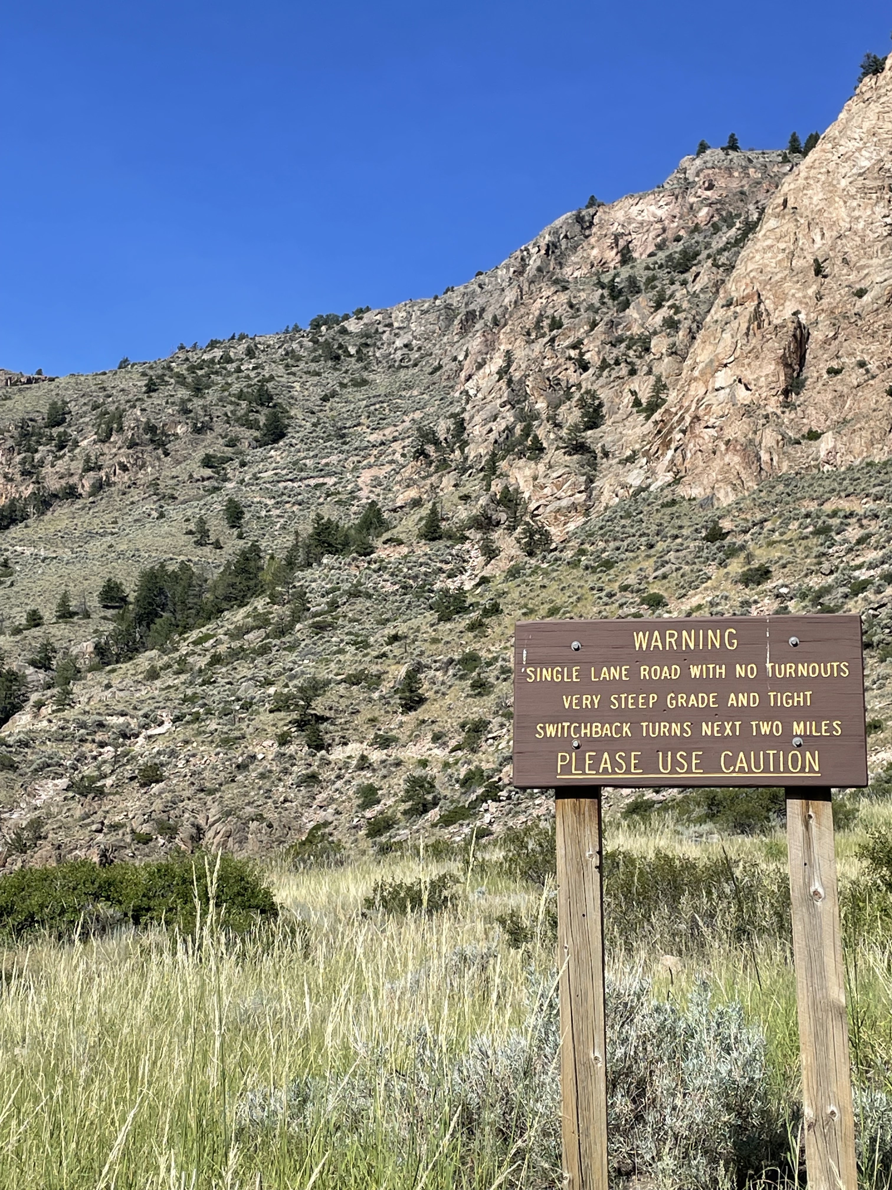
The history of the trail dates back to 1877 when Chief Joseph and the Nez Perce Indians used this route to escape from the US Army. Today it is known as a challenging four wheeling trail because of its' tough rocky terrain and 27 tight switchbacks on a narrow and steep shelf road. Along with that you also experience breathtaking mountain and valley views, numerous high elevation lakes, wildlife, forest and canyons. During our visit we would not be able to drive the entire trail, more specifically, the 27 switchbacks on the steep edge due to landslides from two years of heavy storms that have not been repaired yet. So our adventure would start from along the Beartooth Plateau Scenic Highway going in 9 miles to near the top of the switchbacks and then back the same route. On another day we explored the bottom along the waters edge of the Clarks Fork River Canyon to the bottom of the switchbacks. The Forest Service says they have received funding to repair the switchback next year... a good excuse to come back and experience the entire trail when it does reopen.
 |
| Sawtooth Mountain |
 |
| Views to the South of the Absaroka Mtn. range from 10,000 ft elev. |
 |
| More views for miles of the Absaroka range to the NW. |
 |
| Western Slope 4-Wheelers group |
 |
| Great lunch spot ! |
Morrison Trail: Lower access:
The following photos were taken from our drive to the lower entrance of the Morrison Trail along the Clarks Fork River Canyon looking up at closed switchback area.
 |
| The closed switchbacks are in the background. Barely noticeable in the photo. |
 |
Clarks Fork River Canyon
|
 |
Bridal Veil Waterfall in Clarks Fork River Canyon
|
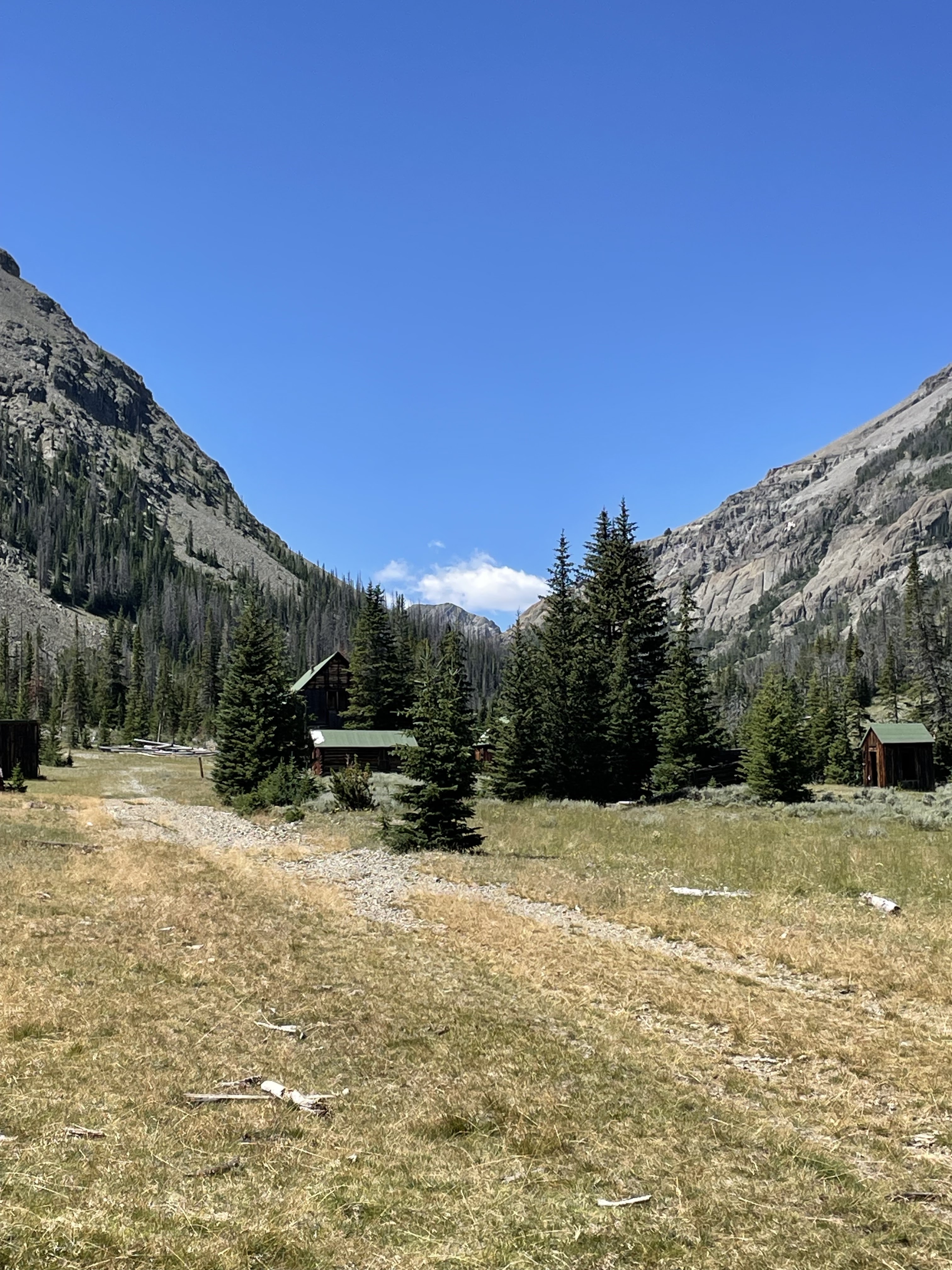
Kirwin Ghost Town:
Located in the southern Absaroka Mountains along a fork of the Wood River sits the building remains of what was once a booming mining town. From the late 1800s to 1907 several hundred residents called Kirwin home. The mining brought in more businesses including a sawmill, general stores, a boarding house and a hotel. Unfortunately the amazing close backdrop of the mountains also came with avalanche hazards and ultimately an avalanche was the towns demise. A huge storm passed through town in February of 1907 and an avalanche roared through town killing 3 people and destroying several buildings. With all things considered once the storm cleared most of the people packed up and left to never return. The town is managed by the Forest Service and volunteer groups help to preserve the buildings.
 |
| Kirwin as seen during our visit - August, 2023. |
 |
| The old boarding house and other Kirwin buildings. |
 |
| One of the main mines right in town with its vertical shaft enclosed head frame. |
 |
| Vertical shaft winch still in place. |

After enjoying four days of 4-wheeling with our friends we were able to stay a couple more days and explore some more places around Cody. According to the Trip Advisor one of the top 5 things to do was visit the Buffalo Bill Center of the West and we can second that. We've never been to a more impressive museum. It actually houses 5 museums: The Buffalo Bill Museum: The Plains Indian Museum; Whitney Western Art Museum: Draper Natural History Museum and the Cody Firearms Museum. It is so big that admission is for 2 days, if needed, and we did!
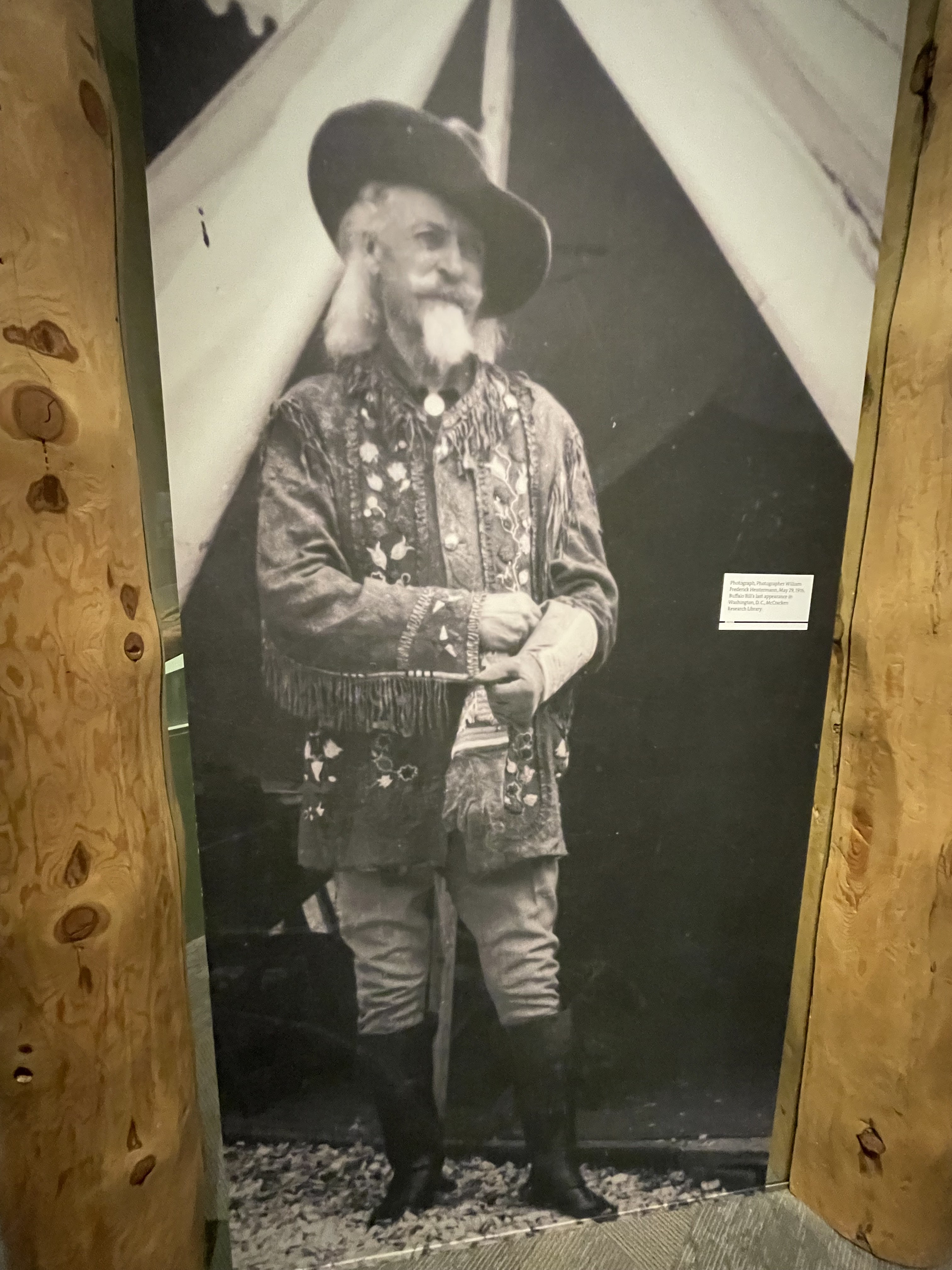
Buffalo Bill Museum:
This museum depicts Cody's life and many family artifacts are on display. In his early life Cody gained notoriety as a scout and guide. During this period he also picked up his nickname of "Buffalo Bill" after the American Civil War when he had a contract to supply Kansas Pacific Railroad workers with buffalo meat.
The Plains Indian Museum:
This wing of the museum displays the history, art and culture of the Plains Indian peoples. We were very impressed with the headdresses and bead work.
 |
| Beautiful bead work |
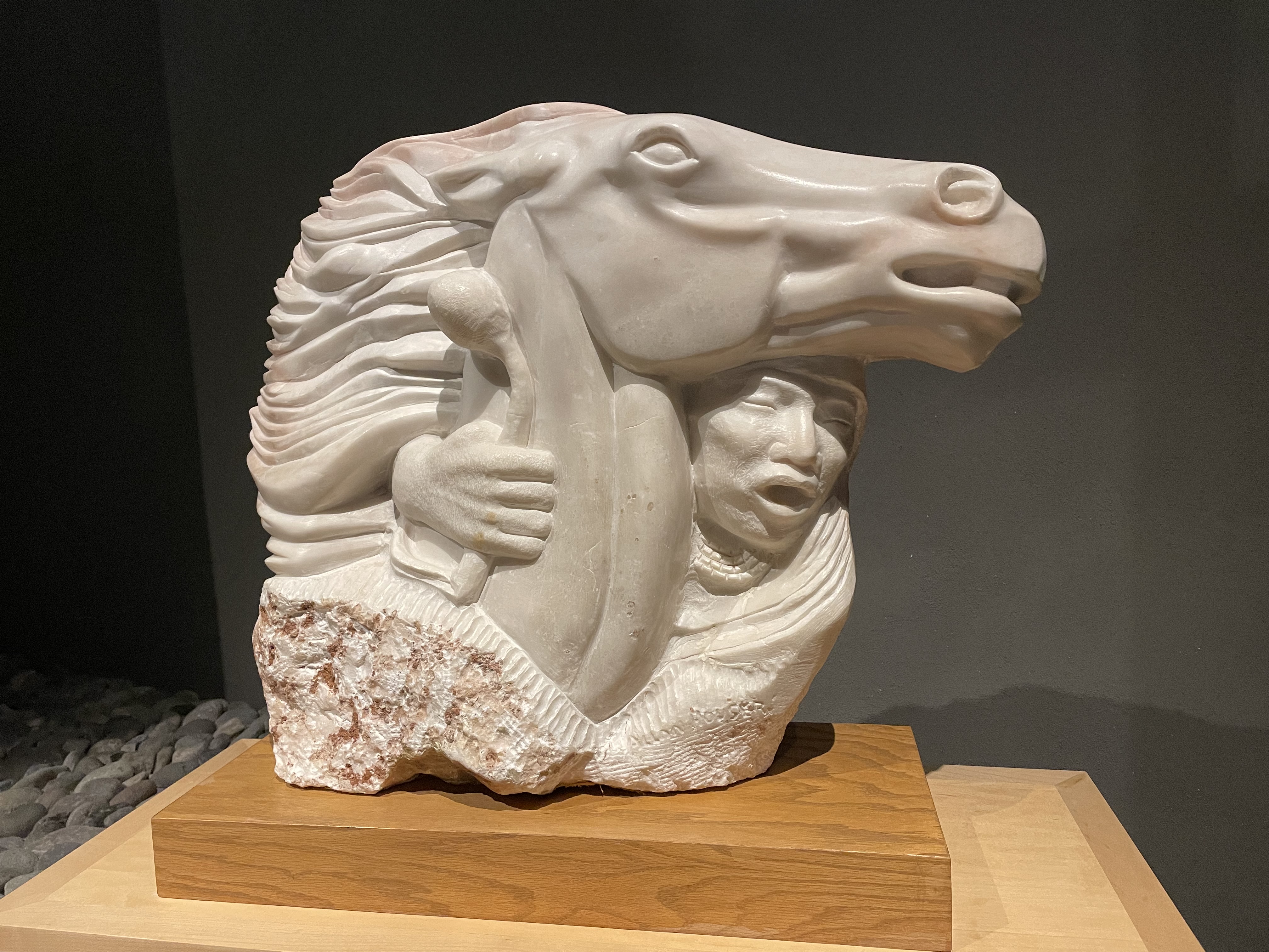
Whitney Western Art Museum:
We were in awe as we walked among many different styles and types of paintings and sculptures mostly depicting the West.
 |
| This is a painting and not a photo...unbelievable detail ! |
 |
| Cody himself |
 |
| Lower Yellowstone Falls by Albert Burstadt |
Draper Natural History Museum:
We describe this museum wing like a walk in nature. It deals with so much of the wildlife found in the Wyoming and Yellowstone area. The design and layout of the displays are very well done. The wildlife and natural land features were grouped in different 'zones' beginning at the bottom floor (which dealt with elevations below 5000 feet) and worked its' way upward until you were examining natural features and animals which occur above 10,000 feet.
 |
| A good graphic comparison on the two types of bears... showing why a grizzly is so much more dangerous with just a swipe of its paw. |
Cody Firearms Museum:
Even if you are not a gun enthusiast this museum does have very informative history displays and leads you through time with relationship to the type of firearms used. They had many hands-on displays and the most comprehensive variety of firearms that we have experienced. This place holds everything from the entire Winchester Collection (basis of the collection) to machine guns, to BB guns and everything in between. Beautifully hand crafted guns to ones that were used in movies and TV series. We thoroughly enjoyed this wing of the museum and spent the most time here. There is sooooo much to see.
 |
| Racks and racks and racks of nicely displayed guns. |
 |
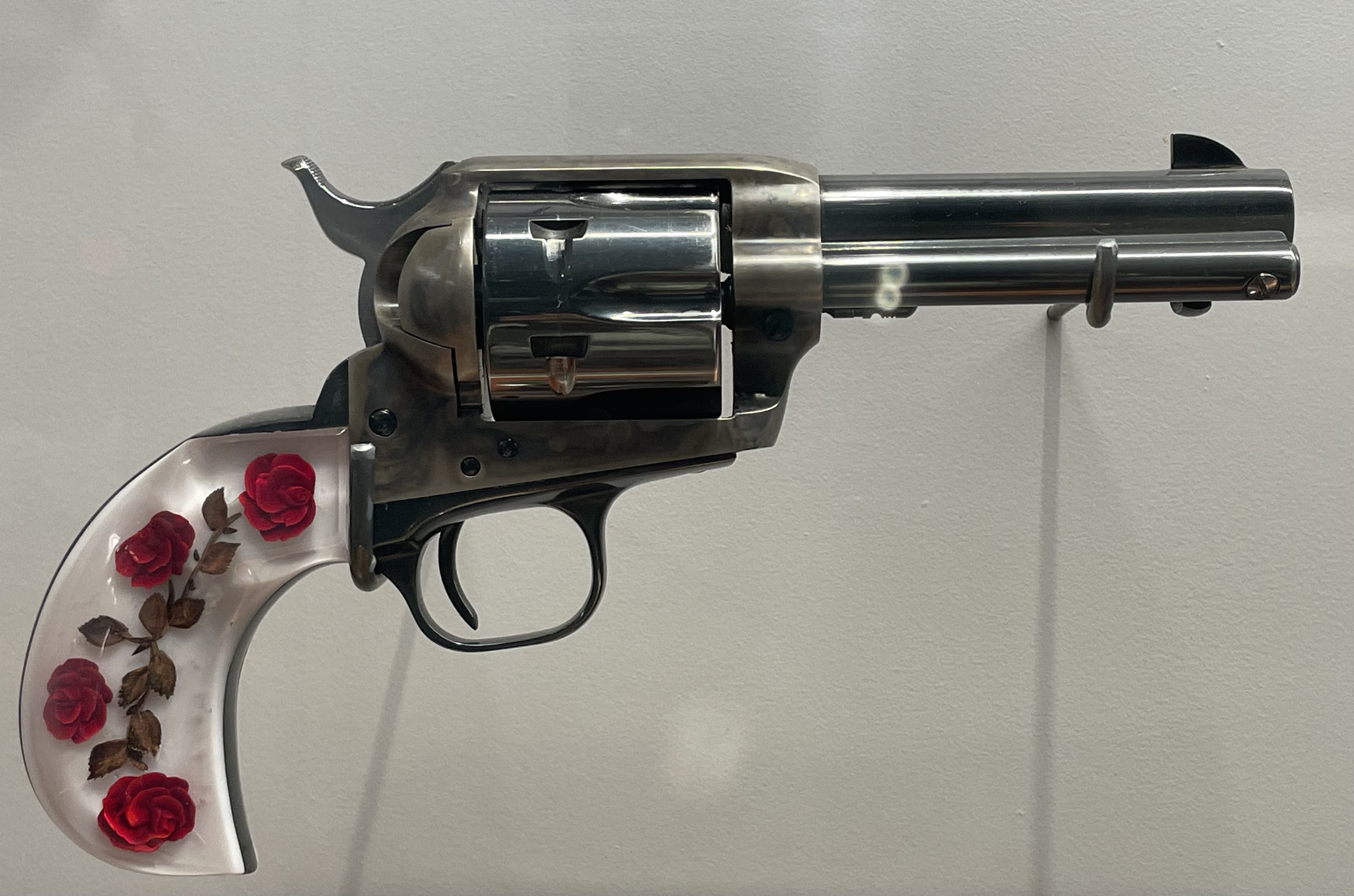
| Love the rose handle. |
 |
| Art work meets function |
 |
The gun used by the Lone Ranger (John Hart) for one season of the
television series. This embellished firearm belongs to him.
It's a Colt Single Action Army Revolver |
Beartooth Highway and Chief Joseph Scenic Loop.
The Beartooth Highway is the section of U.S. Highway 212 between Red Lodge, Montana along the southern border of Montana and winds in and out of Wyoming going to Cooke City Montana and the north entrance of Yellowstone. It traces a series of steep zigzags and switchbacks along the Montana-Wyoming border to Beartooth Pass. This road is considered a National Scenic Byway All-American Road and as the most beautiful highway in America and we knew we wanted to drive it.
The Chief Joseph Scenic Byway, as mentioned earlier, was the trail used by natives over the Beartooth Mtn. from the Cody area which ties into part of the Beartooth Highway. So since we were on these roads to access some of our Jeeping trails, it was a 'no brainer' to drive the entire scenic loop. Along the route we experienced sparkling alpine lakes, lush valleys, wildflowers, steep switchback roads and snow dotted mountains. Beartooth Pass is the highest motor crossing in Wyoming at 10,947 ft elev.
Finishing our Beartooth Highway road trip we stopped at Red Lodge, Montana for a bite to eat before heading back to Cody for the night. Red Lodge was historically a mining town but now the draw seems to be travelers heading to Yellowstone via the Beartooth Highway. It is a great rest stop with numerous 'home-town' restaurants and shops after we 'white-knuckling' it over the Beartooth roads!
 |
Main Street of Red Lodge, Montana
|
After Cody it was time to start to head back South toward home. We checked the Arizona weather and it was still in the 100s so we made a detour to Montrose, Colorado to stay a couple of weeks in the cooler mountains. While there we enjoyed group four wheeling, sightseeing and lots of fun times with friends.
Up to this point we had found the oldest geocaches in Utah and Wyoming so why not Colorado. That's exactly what we did. WooHoo!!!!
 |
| Found the oldest Colorado geocache. |
Once we settled into our RV park we were lucky enough to do some more Jeeping trips with our friends with the Western Slope 4-Wheelers from Montrose. One trip we drove in to the Grand Mesa area, which took us up to 10,250 ft elev. to the beautiful Leon lake for lunch. On another trip we drove to the Silverton, CO area and explored the Eureka Gulch trail and the Minnie Gulch trail, which both got us into old 1880's mining areas.
 |
| Heading to Leon lake in the thick aspen forest |
 |
| A lot of deep water crossings kept the Jeep bottom clean! |
 |
| This would be a great fall color trail ! |
 |
| Another beautiful lake/pond in the area. |
 |
| The group at the top of Eureka Gulch |
 |
| Looking down Eureka Gulch from 12,200 ft. elev... Perched on the edge is an old cable tram house from the 1900's used to cable ore down the mountain. |
 |
| Great photo of the SW Colorado Mtn. range with the high mineral colorization. |
Well... all good things must end and the Arizona summer heat is starting to cut back touching less than the dreaded triple digits, plus we have some appointments scheduled for the end of the month... time to head home.
*** Time flies by when you are having fun. We enjoyed visiting so many places and experiencing the beauty this Country has to offer. Thanks for stopping by to read about our summer travels. Until next time - Happy Travels. ***