Natural Bridges National Monument & Cedar Mesa
August, 2019
Earlier this year when we returned from the San Miguel Swell area we traveled State Route 95 from Hanksville, Utah to Blanding, Utah where the road led us across the Utah portion of Lake Powell and up into the cedar trees near Natural Bridges National Monument. During that trip we said we would like to come back for a more thorough look at the area so that time had come. The area around Natural Bridges is considered high desert terrain with juniper and some pine trees along with cactus and desert type plants. This area did not offer the mountain top cool temperatures we had been chasing since we started our trip but still it was not as hot as the low desert areas.
We knew we wanted to tour the Natural Bridges NM during our stay so we found a dirt road near there and hoped to find a place to camp for the next week and oh boy we found a great view spot that we could squeeze the motor home into and we were Happy Campers! Even though the day time temperatures were still in the upper 80's the breeze at our site was a welcomed bonus and it cooled off nicely at night for sleeping. We had views of the surrounding canyons and at night we could the see the lights in far away Bluff and Blanding, Utah some 30 miles away and further into Arizona and the Red Mesa area of the Navajo country.
 |
| A camp with a view |
 |
| One of many beautiful sunsets enjoyed at our camp site |
Not far from out campsite was the historic hill called Salvation Knoll. In 1879, as the Mormon wagon train was forging a trail down through the Hole in the Wall area, four men went out on an eight day trip to scout ahead for a route but the men were lost and tired after twenty three days. On Christmas morning 1879, out of food and in fresh snow on the ground, one of the men climbed to the top of the knoll (which seems to be one of the tallest hills around us) where he discovered the landmark they had been looking for and were able to reach the end of the trail and map out a trail for the wagon train. All ends well.
 |
| View from Salvation Knoll - can you see our motorhome? |
 |
| View from Salvation Knoll |
Most of the parks we had visited were known for their arches but the Natural Bridges National Monument displays similar looking formations but are known as bridges. What's the difference you ask? Natural bridges are formed by the erosive action of moving water. Arches are formed by other erosional forces - mainly frost action and seeping moisture - that also enlarge natural bridges once steam erosion forms them. (Per National Park Service) In 1908 President Theodore Roosevelt proclaimed Natural Bridges NM as the first National Monument for Utah. It is also the first International Dark Sky Park named by the International Dark Sky Association in the nation. We were lucky enough to attend a night telescope viewing party hosted by a park ranger and a very large and powerful telescope. We viewed Saturn and it's rings, Jupiter and it's four moons, some craters on the moon and some neat galaxies in the Milky Way.
 |
| Sipapu Bridge (220 ft high, 268 ft span, 31 ft wide, 53 ft thick) |
 |
| Kachina Bridge ( 210 ft high, 204 ft span, 44 ft wide, 93 ft thick) |
 |
| Owachomo Bridge ( 106 ft high, 180 ft span, 27 ft wide, 9 ft thick) |
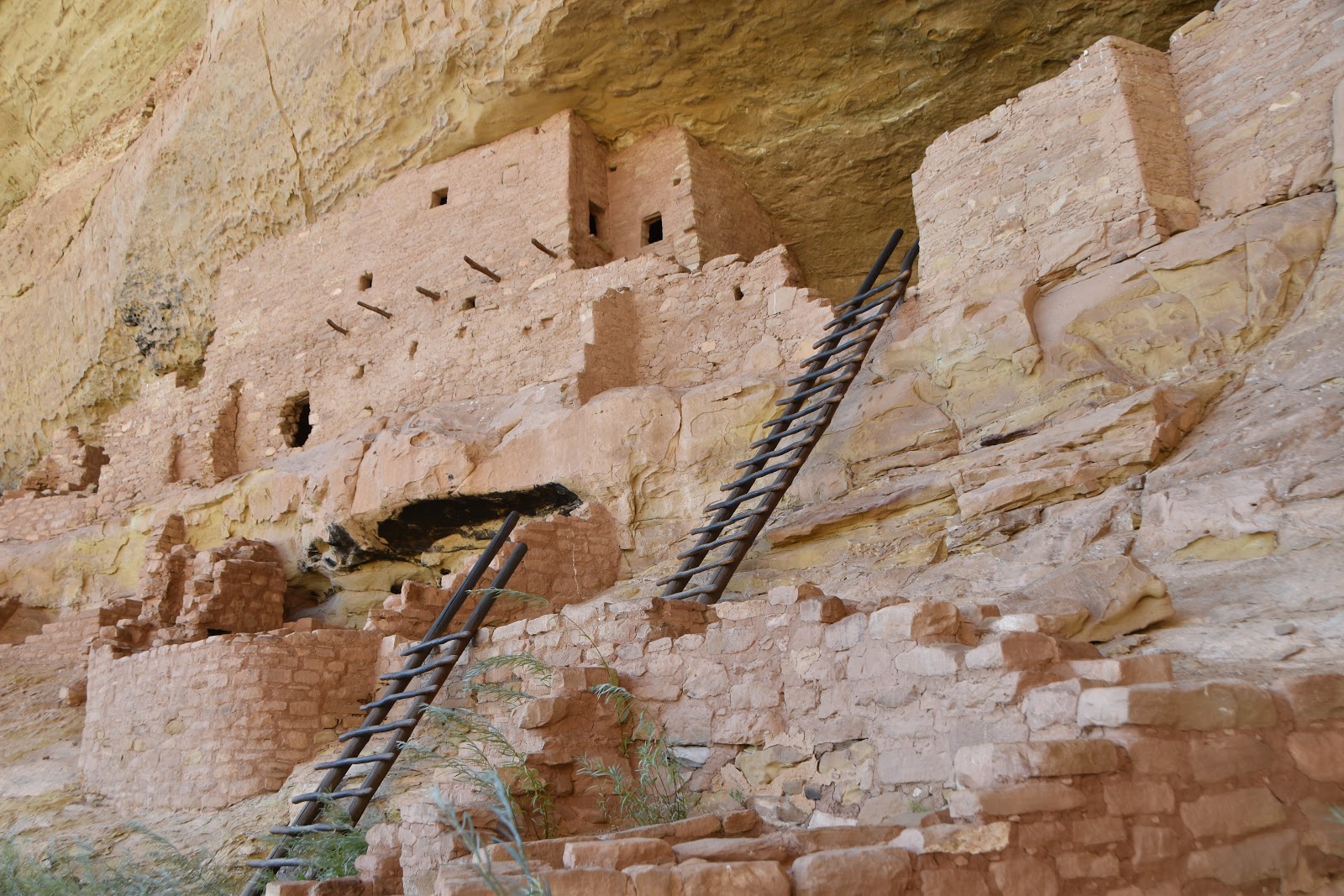
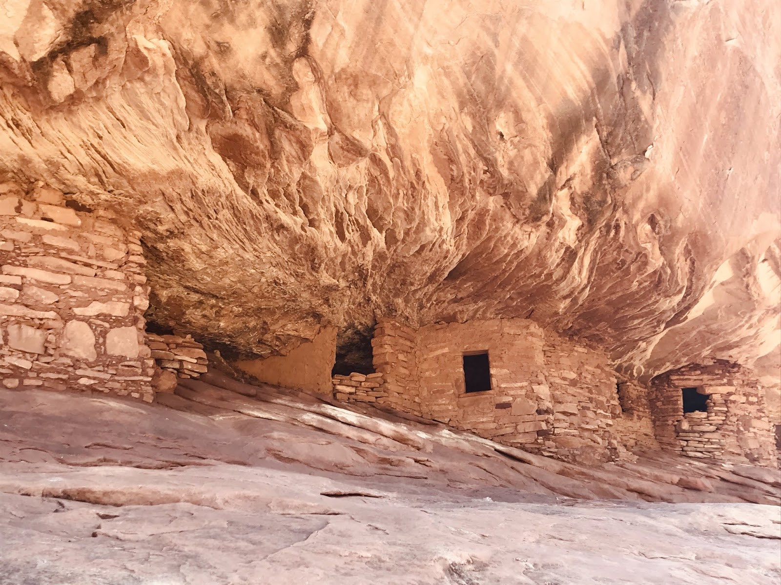
This high desert area offers many dirt road trips and hiking opportunities. We hiked Mule Canyon to a well known and well photographed cliff dwelling called House on Fire. This 900-1500 year old structure is made up of 5 granaries and is built into Cedar Mesa sandstone. So named because the overhang rock face looks like fire during certain times of day. Well worth the two mile RT hike!
 |
| Natural light at the time of day that we were there |
 |
| Another with natural light but showing the name well. |
 |
| Photo taken with a high tint effect to show the nature of the name |
 |
| Kids were doing graffiti a 1000 years ago! |
The area is rich in Puebloan history as evidence by the kivas, cliff dwellings and pictographs. We toured the Mule Canyon Kiva site. This stop offers interpretive information boards that explain the types of surface and undergrounds structures built by the Ancestral Puebloans some 1000 years ago.
 |
| A well built and stabilized 1000 year old Kiva on display |
 |
| The remains of the single story buildings |
After a week of exploring the area around Natural Bridges NM we traveled to Blanding, Utah. Blanding was a good stop for a couple of days to replenish supplies for the next outing. While there we visited the Edge of the Cedars State Park Museum. This is one of the most interesting and informative museums for the Ancestral Puebloans. We thoroughly enjoyed the vast array of ancient pottery, weapons and one of a kind finds. Adjacent to the museum is also an authentic Puebloan village that has been partial excavated by archaeologists. One thinks this is a simple hour long visit to a 'museum'..... Well, we came out four hours later wishing for more time. We've only attached a couple of photographs of the more rare or unusual artifacts in the museum.
 |
Dart Tool Kit - dated during Basketmaker time period (700 to 900 AD) - rolled up inside a juniper mat
which includes the handcrafted dart foreshaft, fletching feathers and sinew for tieing. |
 |
| Necklace made of insect legs and shells. Up close the legs were shiny. |
 |
Beautiful and well preserved Macaw feather sash - 1050-1150 AD -
feathers from Scarlet Macaw which are known to be from
Mexico - used for ceremonial purposes |
 |
Story Pot - 1150 AD - Unusual because it is decorated with animal and human figures.
Black on white pottery in the Southwest typically is decorated with geometric designs.
The canteen appears to tell the story of a bird that was hunted but got away when it
caught the arrow that was aimed at it |
 |
| Some of the Ancestral Puebloan Archaeological site |
 |
| Entering the Kiva |
 |
| Sample of outside 'yard' art work |
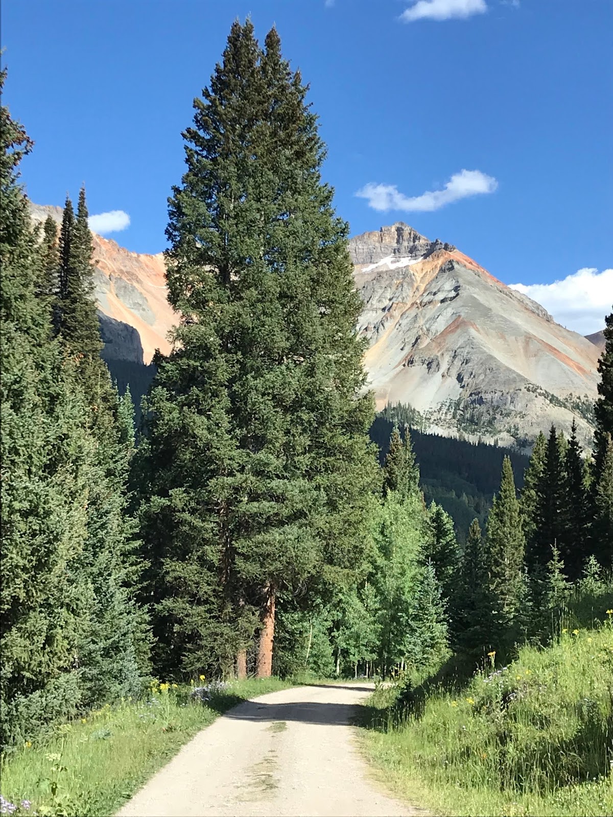
Still in search for cooler weather we decide to go back to a place we know would be cool - Colorado. Join us next time as we share the beauty of Colorado and our breathtaking mountain top camp site.
Happy Traveling
Jack and Deb