Part 1 - Utah
Once again (our 6th year) we signed up for the annual Easter Jeep Safari (EJS) in Moab, Utah held the week before Easter Sunday. It was a week packed with trail adventures, meeting people from around the Country plus oohing and awing at thousand of off-road rigs. During EJS the town in crazy busy with off-road enthusiasts but Moab is also a known destination for biking, hiking, rafting, cliff climbing and rappelling plus the beautiful scenery which surrounds the town. If you haven't visited Moab we highly recommend it.
 |
| Metal Masher Trail - lunch stop - La Sal Mountains in background |
 |
| Jack driving up Wipe Out Hill - no problems |
 |
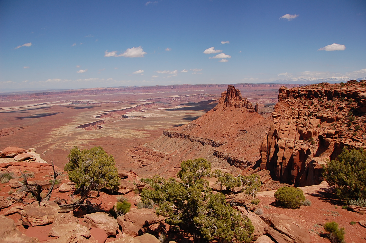
| Uranium Arch |
 |
| Monitor and Merrimac Buttes |
 |
| One of a couple obstacles on the Tip Toe Behind the Rocks Trail |
After a non-stop week at EJS in Moab of four wheeling and vender shows we ventured over to the San Rafael Swell area to meet up with some friends and members of the Western Slope 4-Wheelers from Montrose, CO for a week. It was a two hour or so drive from Moab and we were anxious to visit the area and do some more Jeepin' plus hiking.
From I-70 just past Green River, we turned south on State Road 24 to Goblin Valley Road to catch up with the rest of campers parked at the foot of Wild Horse Butte on BLM land.
A brief history of the area. According to Utah.com eons years ago the area of San Rafael Swell formed tremendous geologic upheavals which formed a giant dome of rock - a 'swell' in the earth's surface. The harsh elements beat against this dome and eroded it into a wild, broken array of multi-colored sandstone. Wind and water carved this jumble of rock into incredible formations as buttes, canyons, pinnacles and mesas emerged, making the Swell one of the most ruggedly beautiful pockets of terrain in the World. That was how this area came to be known as San Rafael Swell.
During our visit we experienced the beauty of the slot canyons, towering buttes, four-wheeling, hiking and eye catching sunrises and sunsets.
 |
| Our group at Wild Horse Creek BLM Camping area |
We started the week off with an epic hike through the Little Wild Horse and Bell Canyons. This hike/trail was about 9 miles through sandy washes, slot canyons and old Jeep roads. We had 10 in our group that scrambled up /over/down boulders, tiptoed around water pockets, squeezed through narrow canyon walls and trudged through sandy washes. The Little Horse slot canyon alone was an amazing 3.5 miles of narrow and tall red rock walls to marvel at which we are still in awe of. To say that this was a great hike is putting it lightly. Is it one that we would do again - heck yes!
The other days were a mixture of short hikes to beautiful arches and back-country dirt roads. We hiked a short distance to Wild Horse arch to view some pictographs and a large cave with a neat oculus (hole in the ceiling).
 |
| Pictograph (painted) panel |
Another stop was The Temple Mountain Wash Petroglyph & Pictograph Panel which contains some of the largest prehistoric painted figures in Utah. The largest is presently 6 feet tall. As you will see in the photo that the wall/panel is chipping away and they guess the original figures would have been about 8 feet tall.
We four-wheeled on the Behind the Reef Road exploring Temple Wash and the Temple Mountain mining area. It was an area full of mining history and the road was, in some places, an 4 wheel drive adventure but also was very scenic with uphill climbs, sandy washes and tight squeezes thrown it. Once on the McKay Mesa we were lucky enough to see a band of wild horses.
 |
| Shelf road |
 |
| Tight fit ! No Jeep was harmed in the making of this photo. |
 |
| This is the closest we could get to the wild horses before they started to run away. They weren't letting us get too close. |
After recouping from the long canyon hike a couple of days ago it was time to do another great hike to the Horseshoe Canyon Unit of Canyonlands NP to transverse down the canyon to the Great Gallery of Barrier Canyon pictographs. We had our choice of a long 3.7 hike down in the canyon or a shorter 1.5 hike but all ending up at the same place. A couple of us chose the shorter hike not knowing that it would be steeper than anticipated nor knowing it was called "Deadman's Trail", plus we had to drive about hour more on dirt roads to get to our starting point, as apposed to the other half of our group that did the longer hike. Since we did the shorter hike we did miss some of the other panels in the canyon but we later saw some amazing photos of those panels. We survived our hike down into the canyon, met up with the rest of the group and enjoyed lunch while taking in the amazement and the beauty of the pictographs. The hike out was tough and hot but we all made it out in good spirits.


 |
| Horseshoe Canyon |
 |
| The steep part of Deadman's Trail was challenging coming down and especially going back up. Yikes |
 |
| The Great Gallery |
 |
Wild burros. NPS keeps close tabs on the population of the burros. They can cause lots of destruction
if they become over populated. |
To Be Continued ....... Part 2 will be out soon.
Happy Travels