Itinerary: Attending one of the greatest off-road events in Moab, Utah
The Easter Jeep Safari (EJS) in Moab, Utah has become an annual event for us. This was our 8th year to attend and there is always something new to see and new trails to conquer. The event itself dates back into the 1960's when the Moab Chamber of Commerce saw it as a way to welcome the 4-wheeling visitors (mostly Jeep owners). Now off roaders flock to Moab for EJS to drive the most beautiful and rugged trails in Moab. This year they even had attendees from Australia and Japan. It's not only the experience to drive the trails that attracts off roaders but the opportunity to see the newest and changing products that are available for 4-wheeling vehicles which is displayed at the vendor show.
We have put together a montage of our travels to Moab, the trails enjoyed, historical finds and the beautiful scenery along the way.
On the way to Moab we stopped in the small town of Bluff, Utah for a couple of nights so we could visit scenic sites in the area. A couple that are close-by are Goosenecks State Park, the famous Moki Dugway switchback road and Muley Point.
Goosenecks State Park is a remote state park in Utah overlooking into a deep meandering canyon of the San Juan River. The surrounding area was rugged desert with sparse vegetation but once to the edge of the canyon the views were breathtaking with its many colorful rock and soil layers and 1,011 foot depth plus the twist and turns of the gorge are something to experience. Considered the most prime example of an 'entrenched meandering river' in North America because the net travel of the river water from East to West is only 1.5 miles but the river travels over 6 miles to gain the 1.5 mile distance.


Moki Dugway - What does it mean you ask. 'Moki' is a local term for the ancient Puebloan people who inhabited the Colorado Plateau hundreds of years ago and 'Dugway' is a term used to describe a roadway carved from a hillside. The Moki Dugway winds 1,200 feet from top to bottom on three miles of graded gravel at an 11% grade with no guardrails. It contains tight switchbacks and shear drop offs. The crest of the Dugway offers massive views of the rock formations in the Valley of the Gods to the East and even Monument Valley to the West. Historically, it is part of the Trail of the Ancients, a national scenic byway. Well worth the drive.
Muley Point - At the top of the Moki Dugway, we did a little off-roading and found a great overlook view point called Muley point. The area always amazes us with abundant history and ancient old formations.
After a day of sightseeing we drove to Blanding, Utah for dinner and of course I happened to see there was a geocache not too far down another dirt road. So Jack made the turn and when we arrived at the geocache coordinates we found a wooded area with a creek which we followed to where the cache should be but we had no luck finding the cache. But what we found instead was quite a surprise. An ancient Native American granary tuck up on the side of the hill. Great ending to the day even though I did not find the cache.
Once we arrived in Moab we had three scheduled days of Easter Jeep Safari trails. The trails were Hellroaring Rim, Deadman Point and Porcupine Rim.
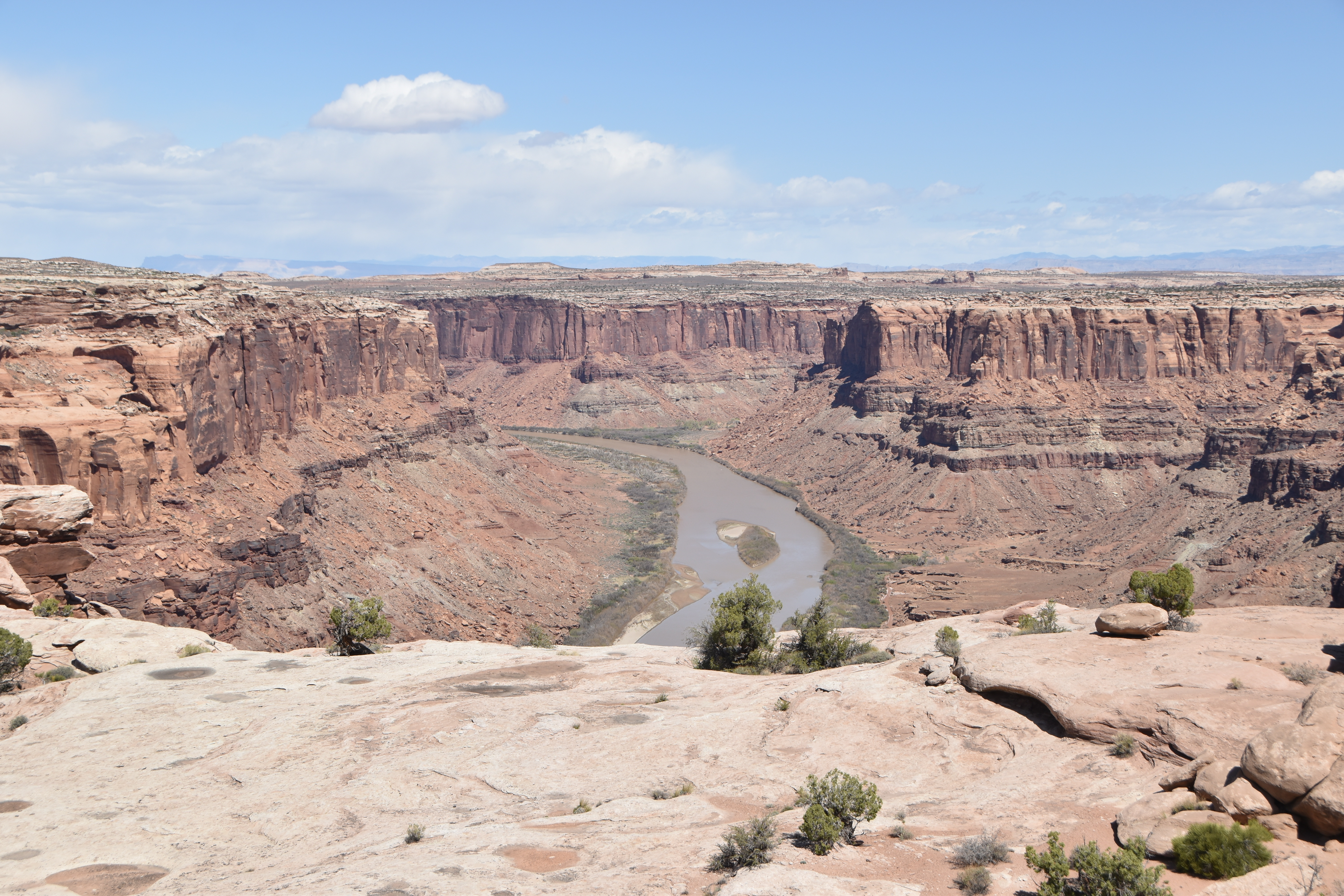
Hellroaring Rim Trail: We woke up to start our day with a surprise - SNOW! ❅❆❆ This made for a interesting and beautiful day on the trail. The snow was light and was mostly gone by the time the trail run started but the air was chilly with the wind blowing. The trail gets its name because it transverses along the Mineral and Hellroaring Canyons. Along the trail we had glimpses of Hellroaring Canyon most of the way but the final overlook was an exceptional cliff edge view overlooking the Green River.
 |
| Our group lunch stop. Couldn't ask for a better place. The canyon is just to the left. |
 |
| Looks like a turtle |

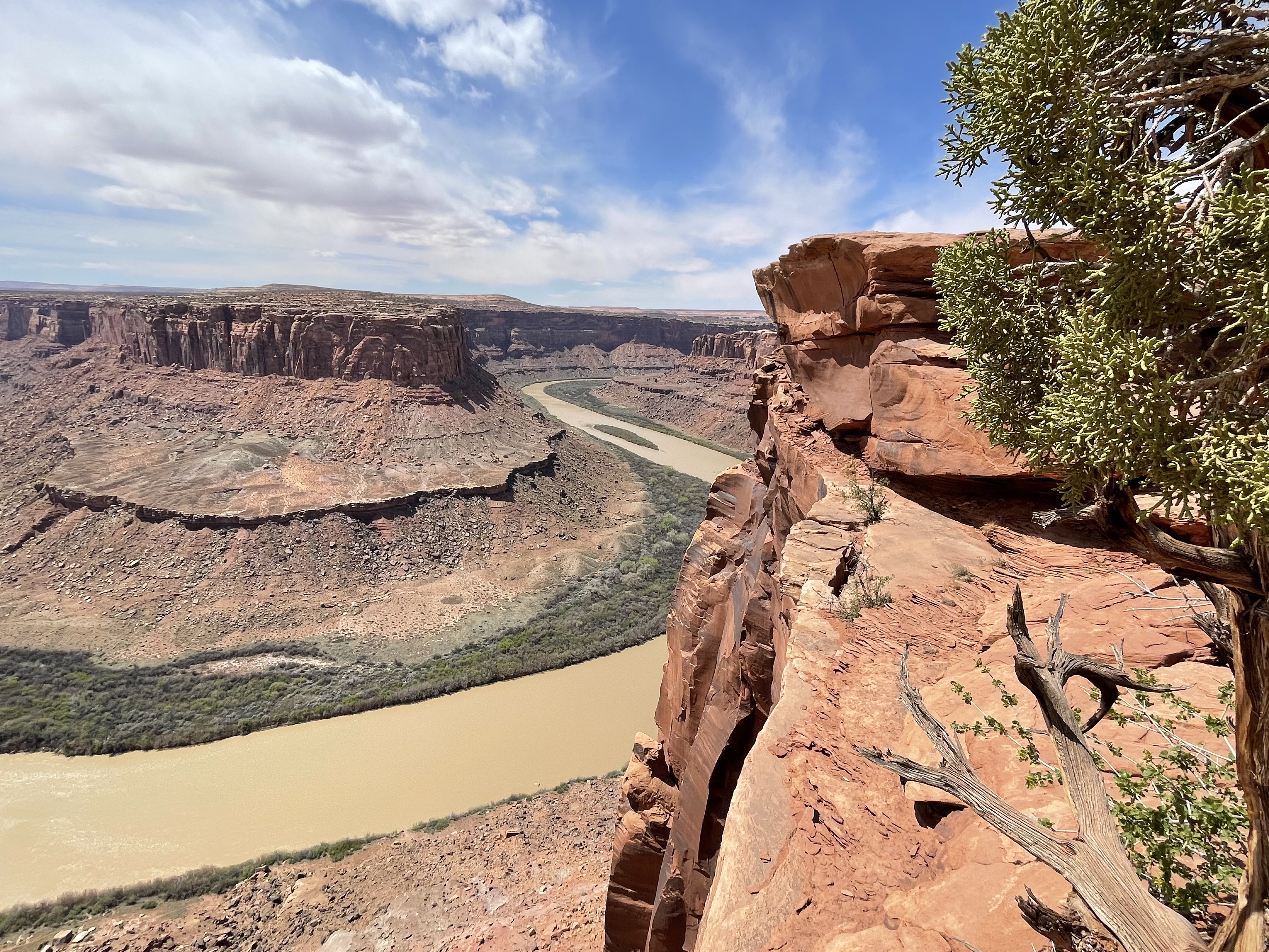
Deadman Point Trail: This trail also gave us great views of the canyons and the Green River below. The day was a little warmer but still chilly with wind but beautiful and even clear enough to see large formations in the Maze District of Canyonlands National Park some 25 miles away. The trail itself had easy rock and dirt sections and occasional ledges just to keep us on our toes.
After two days trail 4-wheeling we had a break before the next trail run to take it a little easy and find a geocache or two plus visit some pictographs that our trail leader had recommended. Not far from Moab we turned down a sandy dirt road until it ended at the Bartlett Rock Art Panel. Located high on the cliff wall in the alcove are a number of pictographs (painted on the rocks). Some say these pictographs are alien-like figures and even read that they were featured in a documentary.
 |
The massive rock face where Bartlett Rock Art Pane is located. Look at middle
of photo just left of dark stain lines you can see the pictographs. |
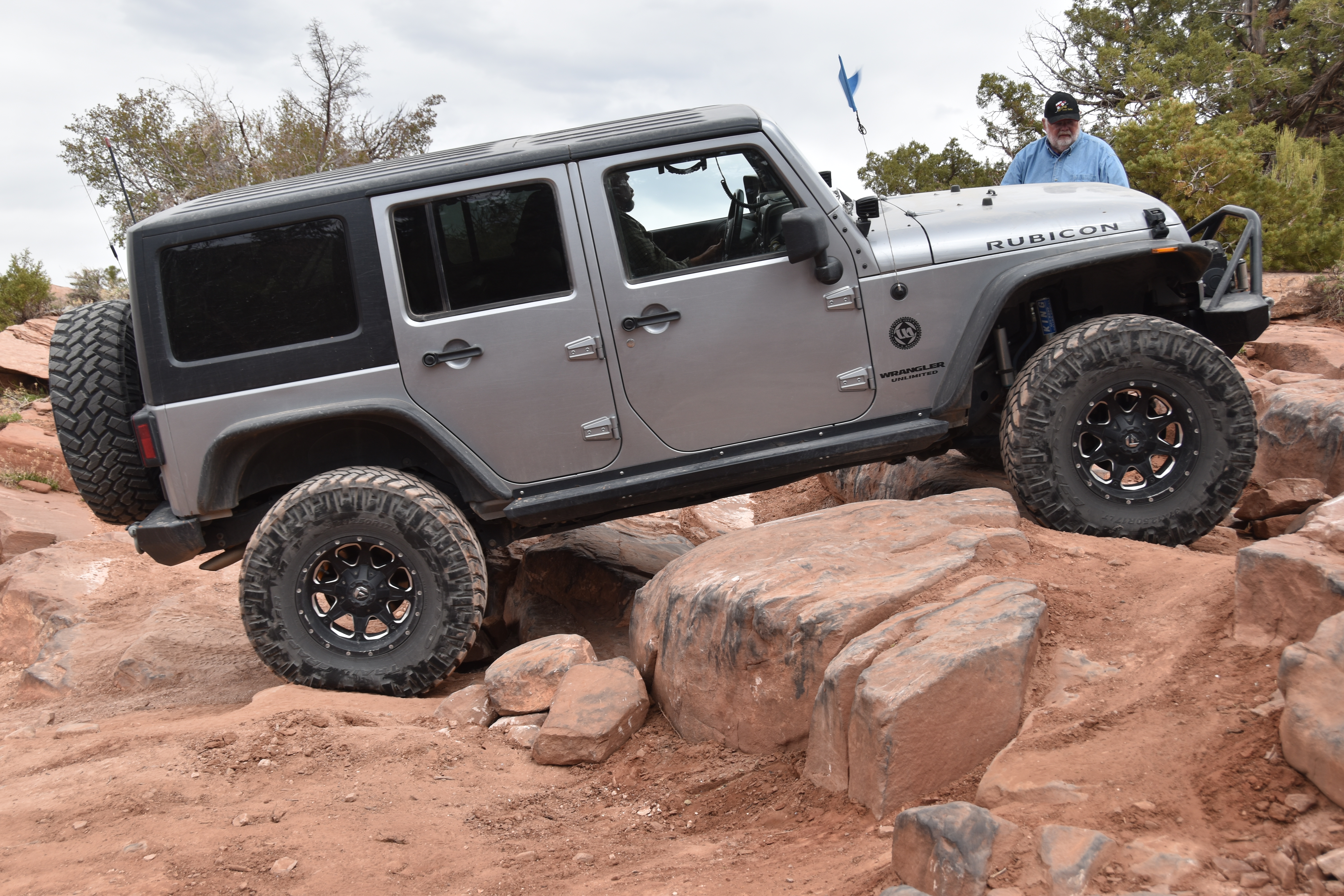
Our third and final EJS trail was Porcupine Rim. When you think of 4-wheeling this trail has it all. The best scenic views, rough rocky road, large boulders to drive over and off camber ledges to maneuver. One of many great attractions of the rough trail is the stunning view it offers of La Sal Mountains on one side and Castle Valley and its renowned rock formations on the other. Rock climbers from all over come to this Valley at a chance to climb Castleton Tower.
As we transversed the trail we soon found out why the trail was named Porcupine as our tires tiptoed through the many 'steps' of sand stone shelves along the canyon edge that are eroded to made a bumpy ride.
 |
| La Sal Mountains |
 |
| Castle Valley, Utah |
 |
| Jack drove the Jeep out on this ledge called Picture Rock for that memorable shot. |
 |
| Castle Valley, Castleton Tower, Rectory, Priest & Sister Superior rock towers |
 |
| Over the boulders |
 |
| Up the ledges |
 |
| Beautiful Castle Valley with its tower rock monuments |
So until next time..... Happy Trails.
Enjoy your adventure.


No comments:
Post a Comment